
01 / 10
Land Survey
Accurate plot, parcel and boundary surveys for residential, commercial and agricultural land in Tamil Nadu and across India.
Deliverables
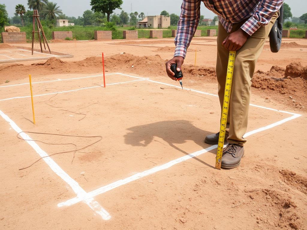
- Boundary demarcation
- Plot area report
- Coordinates & sketch
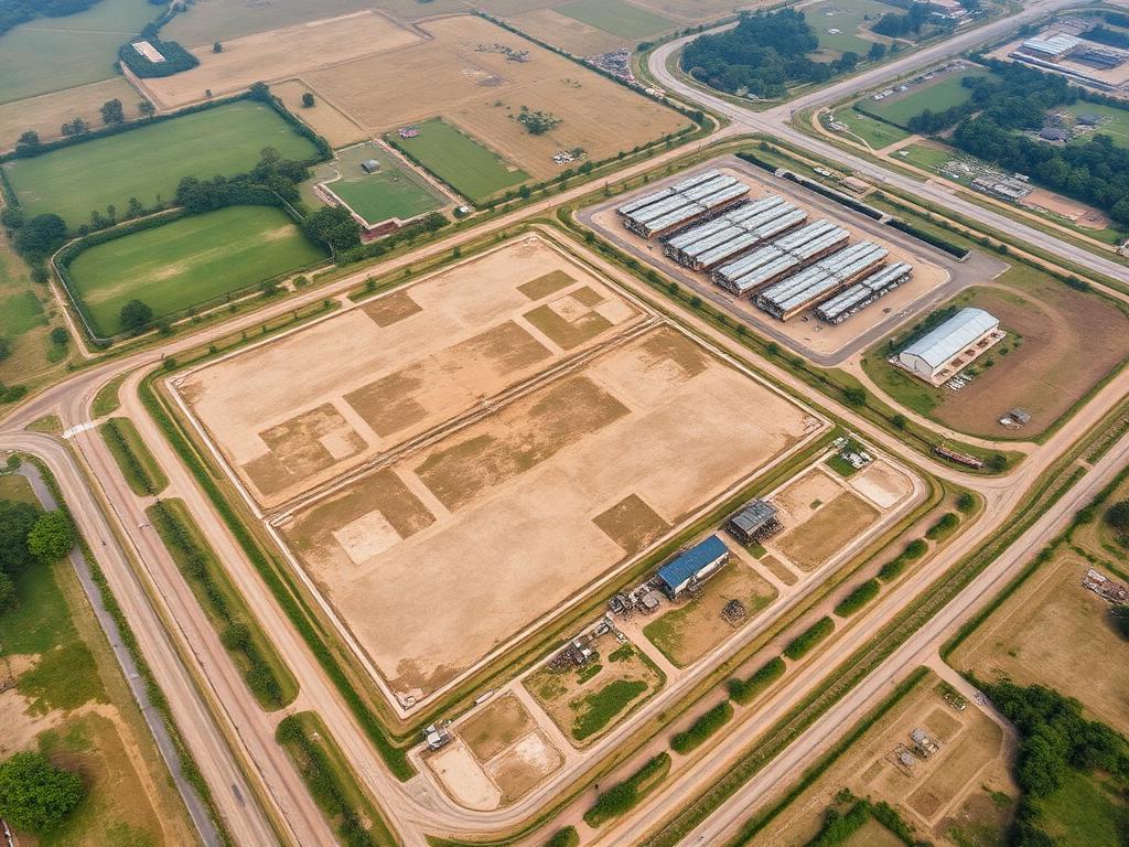
From plot-level boundary verification to 2,000-acre industrial mapping — we deliver audit-grade surveying across all 28 Indian states and overseas.
Accurate plot, parcel and boundary surveys for residential, commercial and agricultural land in Tamil Nadu and across India.

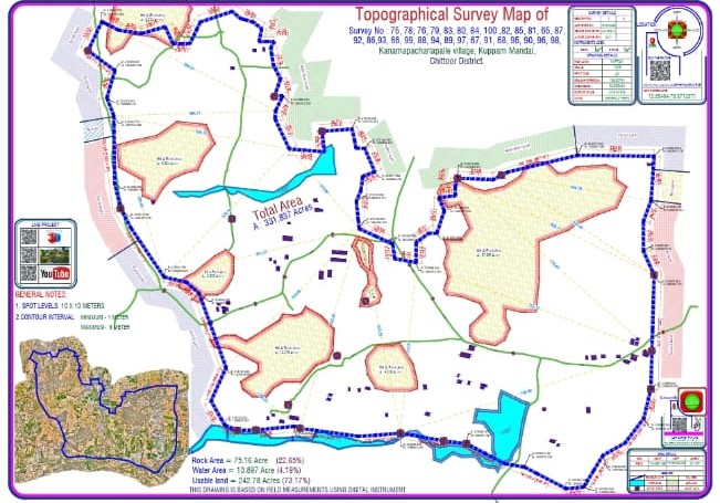
Detailed terrain mapping with spot levels, contours and feature plans for site planning and design.
DGCA-licensed UAV surveys producing orthomosaics, DSM, DTM and photorealistic 3D terrain models.

Verification of property limits, encroachments, easements and revenue records for buyers, sellers and owners.
Plotting and demarcation of approved layouts for builders, developers and DTCP / CMDA submissions.

Pre-construction site surveys with setting-out marking for proposed buildings and structures.
Combined Field Measurement Book sketches aligned with revenue records for legal and registration clarity.
Precise interior floor measurements for architects, interior designers and renovation projects.
End-to-end land due diligence and feasibility surveys for real-estate investments and acquisitions.
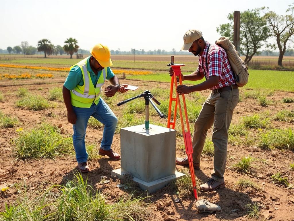
Modern total-station and DGPS-based digital surveys with CAD output for engineering accuracy.
"Engaged LDR for a 12-acre site survey near OMR. Drone mapping was completed in 2 days with detailed contour plans. Highly recommended for builders."
"Professional team, accurate DGPS boundary survey for our farmland in Hosur. The legal documentation they provided made registration smooth."
"Used LDR for land valuation on a 5-acre commercial plot. Their report was thorough and accepted by SBI without any queries. Great experience."
"Very impressed with the 3D drone survey for our industrial project in Sanand. Quick turnaround and accurate output. Will hire again."